Thursday, June 25, 2015

Discovering a Hidden Gem - Tannery Falls

Munising, Michigan (USA) is at the western end of Pictured Rocks National Lakeshore.  This scenic park located in Michigan’s Upper Peninsula stretches along the shoreline of Lake Superior from Grand Marais to Munising.  It has a lot to offer in scenic beauty and recreational opportunities.  For us, that means hiking the trails.

At the Visitor Center, we get current trail information.  We have been here many times and this time we want to do something we haven't seen or done … like hiking to Tannery Falls (aka Rudy M. Olson Memorial Falls).
We park the car on Washington Street and cross H-58 where a wooden staircase (maybe 17 steps) goes up the side of the hill to the trail.  From here, the trail is easy to follow.  During our short walk to the falls, we pass by high sandstone cliffs that gently curve along the trail.
Sandstone Cliff
The trail continues to hug the sandstone cliffs and at times we even walk under the overhanging edges.
Overhanging Sandstone Cliff
The walk is so quiet and pleasant.  We have the beautiful sandstone cliff on our right side and down the ridge is Tannery Creek on our left side.

We don’t see Tannery Falls – it comes into view at the last minute.  We cross a short wooden plank foot bridge over the narrow creek and go up the short steep hill to the top for a better view of Tannery Falls (40’ drop) 
Foot Bridge to Tannery Falls
Tannery Falls
After the water falls down into a small pool, it follows the curve in the sandstone wall.  Then, it passes under the foot bridge and continues on its merry way. 
Tannery Creek
We spend some time here enjoying the quiet scenery of this hidden gem.

For more photos and information on visiting Pictured Rocks, I invite you to view my blog post on "Picturesque Pictured Rocks NLS" by clicking on the following link:

The Munising/Wetmore area has a variety of lodging options from National chain hotels to locally- owned places to stay.  Dining choices include subs, pizza, pasties (similar to a pot pie) and casual dining places.   Since opinions, budgets, and preferences vary, I recommend checking a trusted travel source for current reviews on food and lodging.
Family vacations created some of my favorite memories. To start planning your memorable trip to Pictured Rocks NLS, please click on the following link:

Tuesday, June 23, 2015

Canyon Falls - Michigan's Grand Canyon

Canyon Falls & Gorge is a 10-acre roadside park located 14 miles south of Baraga, Michigan on US-41.  This is a great place to get out of the car, stretch your legs, and see for yourself why this area is called the “Grand Canyon of Michigan’s Upper Peninsula”.  

The day is warm and that means bugs.  There is an army of mosquitoes waiting to attack those who don’t take the time to spray on some insect repellent ... and don’t forget your camera!

The trail is an easy mile walk along a combination of boardwalk (through swampy areas) and a well defined dirt trail passing through a mature forest.

Boardwalk trail through the forest
Soon, the trail parallels the Sturgeon River and we begin to see a series of cascading water sliding over black rock. 
Sturgeon River
A short distance later, is the viewing platform for Canyon Falls.  The falls drop 15’ into the canyon.  We climb down to some large flat rocks for a closer look at the falls.
Canyon falls
Beyond the falls the river has cut a gorge into the rocks.
Canyon Falls Gorge
Enthusiastic hikers can find a rustic trail that continues along the rim of the gorge.  
Wall of the Gorge
View of Canyon Falls from across the gorge
We spend about two hours here hiking and enjoying the trail that parallels the river and canyon. 
Trail along the gorge
If you have worked up an appetite, you will be pleased to know there are picnic tables (and restrooms!) in the parking lot area. 

Other food and lodging options can be found in the nearby town of Baraga.  Since opinions, budgets, and preferences vary, I recommend checking a trusted travel source for current reviews on the best places to eat and sleep.

If you are interested in other Michigan Waterfalls, I invite you to view my blog post by clicking on the following link:
I'm A Wandering Waterfall Watcher (Michigan)
Family vacations created some of my favorite memories.  Start planning your memorable trip to Canyon Falls by clicking on the following link:

Saturday, June 20, 2015

Choo-Choose Lake Superior Railroad Museum

All Aboard - for a trip back in time.  The Lake Superior Railroad Museum is located in the historic Union Depot in downtown Duluth, Minnesota.  This green-roofed building was built in 1892 and is listed on the National Register of Historic Places.  There is a fee to enter the museum.  However, if you have AAA or AARP, you can get a 10% discount. 
 Union Depot
After we purchase our tickets, we go down to level one (elevator or stairs).  This is where the locomotives and rolling stock are displayed (and, yes, there are restrooms down here).  
Locomotives
Inside the Locomotive
Kids of all ages will enjoy climbing in and around these giant locomotives and walking through the passenger cars. 
 Parlor Car
 Dining Car
There are interactive exhibits and games for the kids.  While walking around, the kids can be on the lookout for “hobo” signs and learn what each symbol means.  I have fun adapting their “I SPY” game for kids into my version of a photo scavenger hunt.
"I SPY" Game
Hobo Sign (lift the knob to reveal its meaning)
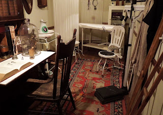
The Depot Square recreates the look of Duluth in 1910.  We stroll down the wooden boardwalk passing a collection of businesses including, but not limited to, a Fire Station, Bank, and Doctor’s Office.  Here we can peek into the past to see how folks lived and worked in 1910. 
Depot Square
Fire Station
Bank
Doctor's Office
If you are in Duluth, and you like trains, you've got to “see ‘em at the museum”.  

For information on the Lake Superior Railroad Museum, click on the following link:


Mystery at the Falls - Judge Magney State Park

Traveling down Minnesota’s 150 mile scenic North Shore Drive is something everyone should experience at least once.  Today, we are at Judge Magney State Park (Mile 123.8).  When it was established in 1957 it was originally named Brule River State Park.  In 1963, it was renamed the Judge Magney State Park and now contains 4,642 acres … and a mystery.   

Located within the park is the mysterious Devil’s Kettle Falls. It is here where the river splits - half of it drops 50 feet and continues toward Lake Superior and the other half disappears into a huge pothole.  No one knows where this water goes. 

This is something we have to see for ourselves.  We hike the trail (2 miles round trip and includes 255 stairs each way).   
Forest Trail
Stairs
We arrive at the Devil’s Kettle Falls.  I am intrigued by these falls.  Where does that water go?  Over the years, researchers have poured dyes down the giant pothole expecting to see the colored-water emerging into Lake Superior.  So far, no evidence of the dyes has been seen.  
Devil's Kettle Falls
For more information on the Devil’s Kettle Falls, click on the following link:

We continue hiking and take a spur trail for a closer look at the Upper Falls.  The breezes shower us with mists from the falls – yup, the falls have mist kissed us.
Upper Falls
For more information on Judge Magney State Park, click on the following link:


Highlighting Minnesota's North Shore Scenic Drive

The North Shore Drive (aka Highway 61) is a 150 mile scenic drive beginning in Duluth and ending in Grand Portage, Minnesota.  There are so many things to see and do … waterfalls, state parks, lighthouses, historic sites, tunnels, and lots of recreational opportunities.   We have printed a mile-by-mile guide off the Internet and are ready to see the sights and sounds of this “Superior” scenery.  Our tour begins in Duluth, Minnesota

Zipping Around in St. Lucia


Brrr!   The 2013-14 winter months are long and we are experiencing unusually bitter cold temperatures.  We need a break from winter.  So, we book ourselves on an 11-day Southern Caribbean Cruise. 


Day 7:  At 8:00 a.m., the ship docks in the capitol city of Castries.  Later today the ship will sail over to Soufriere where the Pitons are located.  They are an iconic symbol for St Lucia.  The Gros Piton is 2,530 feet high, and the Petit Piton is 2,438 feet high. The Pitons are a World Heritage Site.
Pitons

But first things first:  We are doing the “St. Lucia Tram & Canopy Zipline” tour.  We have done this shore excursion on a previous visit but we enjoyed it enough to do it again.  Let’s go zipping!

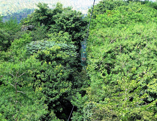
We board bus #17 and meet our driver Herman.  He drives the winding roller coaster roads to our destination Rain Forest Sky Rides.  Here we meet our guides - Clyde and Nicholas.  We are geared up in harness and helmets and board the tram.  The tram slowly glides through the forest for 1.25 miles ascending 800' to the starting point for our zip-line ride. 
Tram Tree Trail
We leave the tram and hike a narrow, steep dirt trail (lots of steps) to our first of nine platforms.  
After we finish the last and longest zip-line, we hike back to the tram platform and ride it to our starting point.  Herman returns with our bus and drives us back to the ship. 

As the ship leaves Castries, we notice a photogenic lighthouse perched high on top of a hill.
St. Lucia Lighthouse
We watch St Lucia fade into the misty horizon and we move closer to our next port – Martinique.

I'll Ask Ya to Alaska - 2013 Sept Alaskan Cruise


After spending a week in Mount Rainier National Park, we arrive in Seattle, Washington where we board Holland America’s Westerdam for a 7-day Alaskan cruise.  This is the Westerdam's last Alaskan cruise for the 2013 season. 

Day 3 – Ketchikan

At 6:45 am, I hear the ship's side thrusters signaling our arrival in Ketchikan  I go outside on our balcony to see what the temperature is like ... definitely winter-coat weather.  Typical for this time of the year, it has been raining and the misty clouds are hovering around the tops of the mountains.  It seems appropriate since our shore excursion today is "Magnificent Misty Fjords by Floatplane". 

We did a similar tour back in 1999 and enjoyed it.  We board the floatplane and put on our seatbelts and headphones.  Up, up, and away ... the floatplane glides across the water and we soar about 1,000 feet above the land and seascape.  Sam (our pilot) tells us about Ketchikan and the land we are seeing.  We enter Misty Fjords National Monument.  We see lots of waterfalls cascading hundreds of feet down mountain sides, a virgin forest, deep lakes loaded with fish, and endless ridges of mountains.  Sam tells us you could fly around for a week and still not see all the scenic wonders this vast wilderness has to offer.  Just like our last visit here, we land on a lake near a waterfall (but not the same waterfall).  Five of us get out and stand on the pontoons to enjoy the quiet scenic beauty.  This is my favorite part of the tour.

            
Misty Fjords National Monument

After our floatplane tour returns to Ketchikan, we still have time for an afternoon tour. This tour is operated by Sourdough Tours and Justin is our guide.  We stop at Herring Cove where we see a black bear foraging for food by the river bank.  At Saxman Village (home to an authentic clan house and the world's largest collection of standing totem poles), we stand in the cold steady rain while Justin gives us a brief description on the totem poles.  We have a few minutes to walk the grounds. 

   
Saxman Village

We return to Ketchikan where Justin drops us off near Dolly's House on Historic Creek Street (former busy red-light district).  Since our tour includes admission through it, we make a brief walk-through visit.  We did a more thorough tour on a previous trip.  We make a quick stroll down Creek Street and through a couple of shops near the pier.  My fingers are so cold I am fumbling to work zippers and trying to handle my ID card.  We are back on-board ship by 3pm and set sail for Glacier Bay National Park.

Day 4 – Glacier Bay National Park
The ship enters Glacier Bay at 6:45am and two National Park Rangers board the Westerdam.  During our early cruising, a pod of Orca whales is seen off the port side and later a humpback whale breaches out of the water.  Unfortunately, we are on the wrong side of the ship to see them.  The good news ... the weather today is great - especially for this time of the year. 

The wispy clouds float around the mountain tops and waterfalls cascade hundreds of feet down the mountain sides.  The Park Ranger tells us the things that look like brown jelly beans on the floating pieces of ice are seals and the white specks on the mountain sides are mountain goats.  A few mountain peaks have a fresh layer of snow.  The ship slowly cruises the 65 miles to Margerie Glacier (a 21-mile-long tide water glacier).  We spend about 30 minutes here admiring the scenery and listening to the berg seltzer crackling and the sound of ice thunder.  We see some minor calving. 
    
Margerie Glacier

On our way to/from Johns Hopkins Glacier, the ship passes by Lamplaugh Glacier and Honnoh Glacier. We enter the Johns Hopkins Inlet which is closed from May to September 1st (due to seal pups habitat).   So, cruise traffic is allowed here only after that date. 
                 
Lamplaugh Glacier    Honnoh Glacier       Johns Hopkins Glacier

We spend 30 minutes here before leaving the Inlet.  At 6:15pm, the park boat comes along side ship and the two park rangers climb down a rope ladder to their small boat that speeds them away to the remote Visitor Center where they are spending the winter.  We leave Glacier Bay and head for our next port of call - Juneau.  

Day 5 - Juneau
When I awake this morning (7:45am), the ship is already docked.  I pull back our room curtains and take a peek out the glass door.   It is so foggy I can barely make out the mountains and the dock area.   However, within the hour, the sun burns off the fog revealing blue skies. 

Our "Five Glacier Seaplane Exploration" is a 40 minute flight over five different glaciers which are part of the 1,500 square miles Grand Juneau Ice Field.  The bus takes us to Wings Aviation where we board our seaplane and taxi down the Gastineau Channel for a smooth water take-off.  It does not take long to arrive at the first two glaciers (Taku and Norris or Nourse - not sure which the pilot said).  The sunny day is adding to the visual delight of seeing the snow/ice fields from the air.  This rugged terrain is full of jagged high peaks and steep slopes. 
Rugged & Jagged Peaks
Our last glacier is Mendenhall Glacier.  It is Juneau's "drive to" glacier.  In previous visits, we have visited Mendenhall Glacier and hiked a few of the trails and saw Nugget Creek Falls close-up but the aerial view of the lake, glacier, falls, and Visitor Center is a new perspective for us.  We return to Juneau with a smooth water landing. 
Mendenhall Glacier

We have some time to  ride the Mount Roberts Tramway.  The smooth 1,800 foot ascent to the mountain top is about four minutes long.  We walk the one-half mile Alpine Loop Trail to a couple of observation platforms.  They offer a bird's eye view of the channel, downtown Juneau, and the Chilkat Mountains  It’s back to the Westerdam for our final port – Vancouver and then back to Seattle.


2014 Winter Storm Ion


Mid-Michigan is barely recovering from the pre-Christmas ice storm when we are hit by another severe winter storm (Ion).  According to Wikipedia, “An Arctic cold front, initially associated with a nor'easter on January 2, tracked across Canada and the United States, resulting in heavy snowfall. Temperatures lowered to unprecedented levels due to the front, and consequently low temperature records were broken across the U.S. 


The freshly fallen, heavy blanket of snow is pretty to look at but it is wickedly cold to be outside in it.  At least we did not lose our electrical power during this storm.  Instead, we stay inside where we are safe and warm. 

I dreaming of a winter tropical vacation …

Kudos to Barbados


Brrr!   The 2013-14 winter months are long and we are experiencing unusually bitter cold temperatures.  We need a break from winter.  So, we book ourselves on an 11-day Southern Caribbean Cruise. 

Day 6:  The ship docks in Bridgetown, Barbados.  Today, we are participating in the “Barbados Turtle Encounter”. 

Our tour is operated by Ocean Adventures.  We board the Silver Moon II with Captain Tony and his crew.  After we cruise across the bay, we arrive near Payne's Beach where we anxiously anticipate snorkeling and swimming with the sea turtles.  We are here for 1.5 hours and no sea turtles are seen.  Just before Captain Tony calls us back onboard, we see one sea turtle.  Usually there are 20+ sea turtles (they were here this morning).  The lack of turtles is a rare experience and we have the unlucky timing of being here at the wrong time.   We climb onboard the boat and Captain Tony moves us closer to shore.

  
Sea Turtle Encounter

At Payne’s Beach, we climb down the boat’s ladder and swim a short distance to shore.  From here, we “slip” onto the banana boat for an “appealing” ride and then we climb aboard an inflatable over-sized lounge chair (up to four people) for another thrilling water ride.  The motor boat speeds across the water and our ride bounces across the wake of the speed boat.  This is a fun thing to do but beware that it is not suitable for anyone with neck or back problems.
  
Banana Boat Ride

We return to the Silver Moon II and sail back across the bay to return to the ship.  We wave good-bye to Barbados as the ship sets sail for St. Lucia.